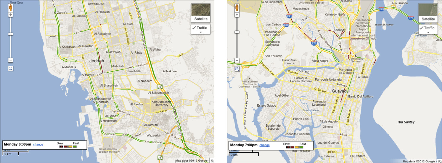
Just as iPhone users are getting accustomed to a life with no public transit directions, no Street View and annoying location search result, Google is continuing to improve Google Maps in places where few people can afford an iPhone.
Well, except for Saudi Arabia, everyone's got a solid gold iPhone 5 already if you believe the stereotypes, and why shouldn't you.
"Now, the maps of these locations are much more useful, as drivers can quickly determine the clearest route to their destinations and reduce the amount of time spent in the car," it said.
"In addition to being able to see current traffic conditions, estimated travel times are also available to ease anxiety and help you plan your trips accordingly," it added.
Google already provides traffic data for plenty of places, the feature has been around for a few years. It relies on several data sources for this, but an important source is Android phones running Google Maps.
Users can opt to send their location to Google periodically and Google uses this data to determine the traffic conditions. For example, if it sees several phones moving at around the same time and advancing only a short distance it can determine that there's a traffic jam.
Of course, availability of the real-time traffic conditions depends on the availability of this data. If there are enough phones in an area or if it can find a commercial partner, it can provide this info in Google Maps.
The data is available on Google Maps on the desktop, just enable the "Traffic" layer, but also in the mobile websites and apps. One place that's not available anymore is the iOS Maps app.
Via: Real-Time Live Traffic Conditions in Google Maps for Saudi Arabia, Kuwait and Ecuador
Tidak ada komentar:
Posting Komentar